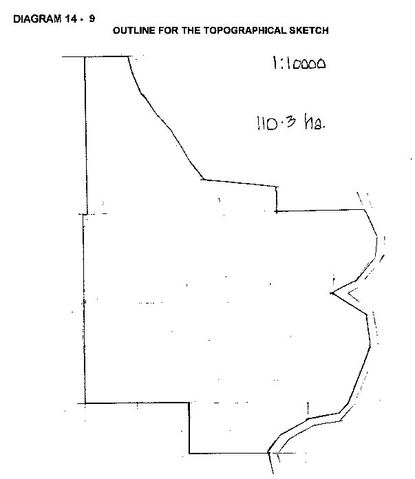
TOPOGRAPHICAL SKETCH
Once the property is legally identified, the boundaries are drawn on the Parish map. The outline is then copied onto a working sheet and becomes the outline for the topographical sketch of the property used on inspection:
This sketch ha been converted to a more useful scale of 1:10 000.
The outline of the property is transposed to the valuer's field book at a suitable scale. Old parish maps at a of scale 1":40 chains or as a RF (representative fraction); 1:31 680 need to be converted to a commonly used metric fraction. To convert 1"=40 chains to a RF of 1:10000 the lengths will have to be increased in size by the ratio of 31 680/10 000 = 3.168.
This is easily done with proportional dividers.
Start the sketch with a soft pencil and using a 1:10 000 scale rule or smaller if the property is large, draw the rectangular boundaries first. Irregular boundaries such as creek lines can then be drawn in by freehand. Use the eraser frequently to improve and correct the sketch. The aim is not the preparation of a survey plan but a clean workable
sketch at a scale sufficiently large to contain all he necessary valuation data.
The north point should be at the top of the page and the RF scale noted in a vacant part of the sketch.
ADDING DATA
The outline sketch is the map that the valuer will use in the field. As the
valuer inspects the property he/she will notice various valuation features which are then transposed onto the sketch. Preliminary data can be added to the sketch in the office using the following maps and photos available from the Lands Department and Crown map sale centres (eg Mapland in South Australia):
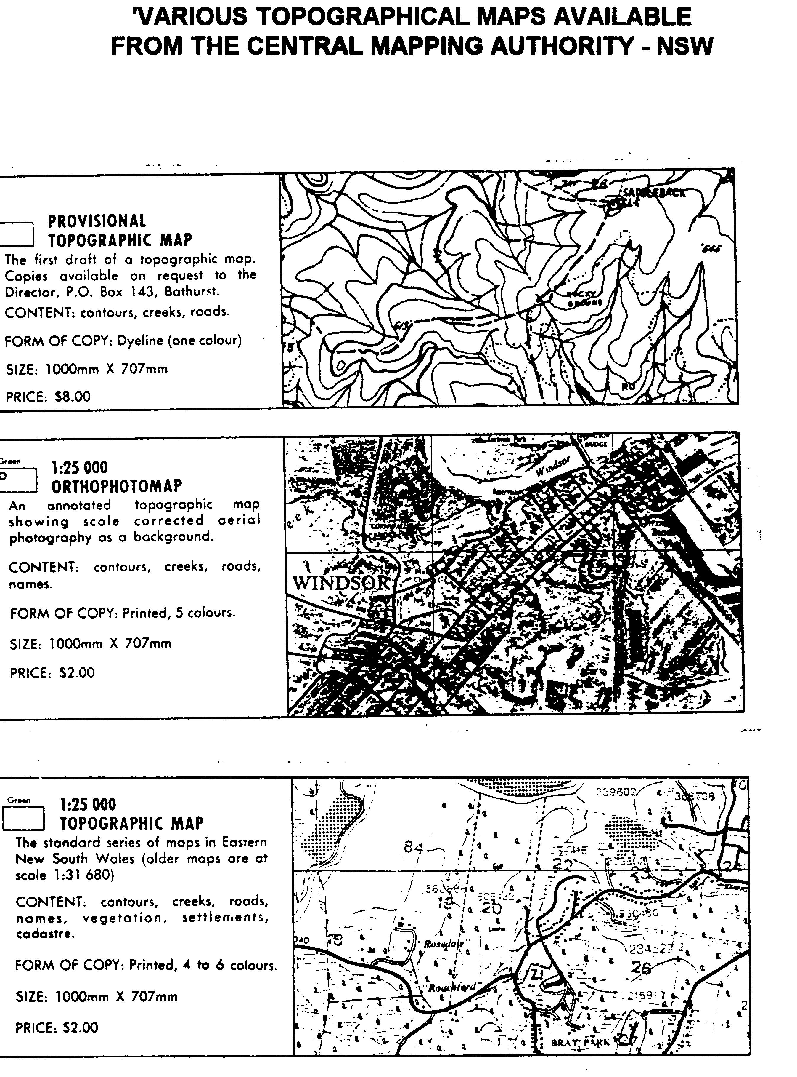
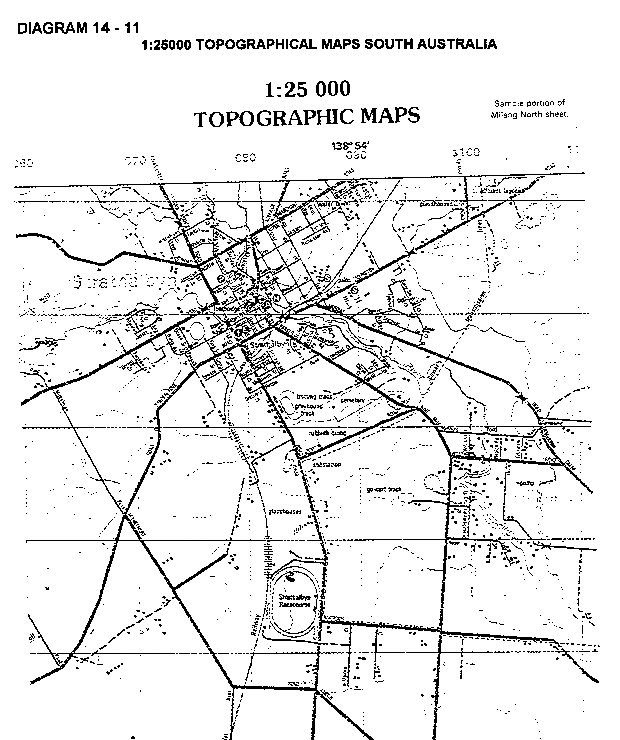
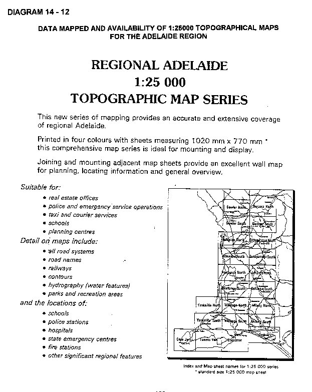
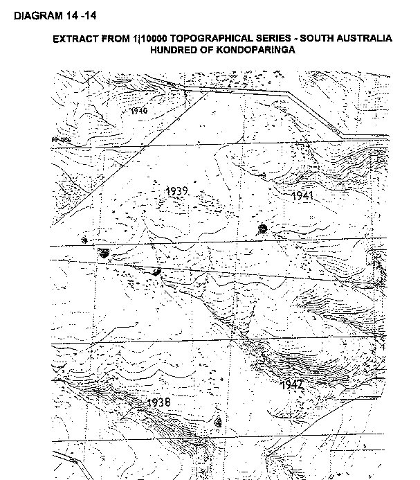
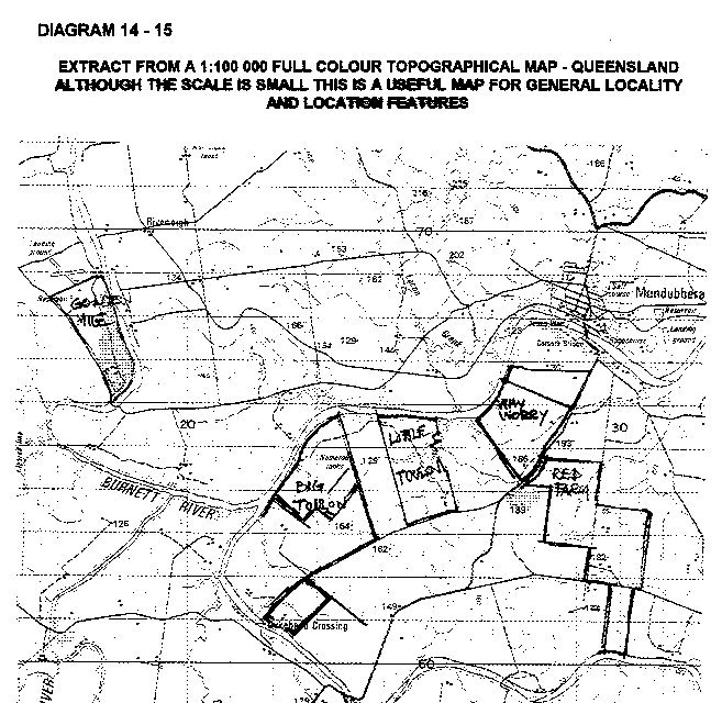
PHOTOMAPS: 1:25000 and 1:50000
TOPOGRAPHICAL MAPS: 1:25000 and 1:50000
AIR PHOTOS: Old photos at various scales but new photos are map.
scales eg 1:40000
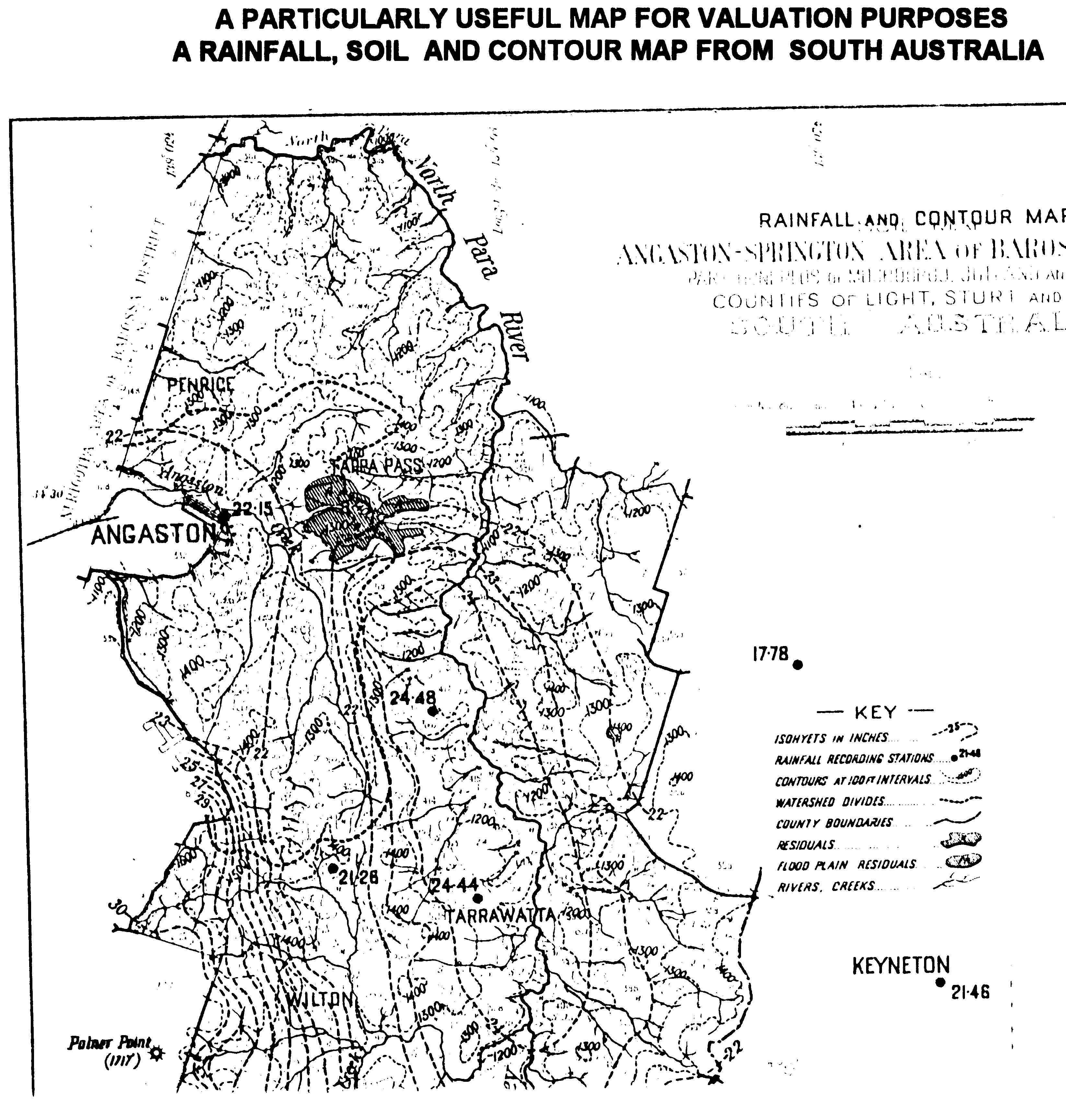
The following diagrams show examples of the various maps and photos available for the use of the rural valuer. The best map when available, is a large scale "full colour" topographic map which although cheap show most valuation features including contours, some cadastral information and extensive tree areas such as orchards and forests.
SKETCH COMPLETION
All relevant valuation data is added to the sketch on inspection of the property using a soft pencil or directly onto the photo using a chinagraph pencil - see diagram below.
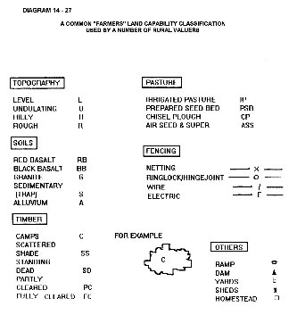
The data is best added according to a code. There are various codes used by valuers for notation on the sketch. These are covered later under land capability mapping.

USEFUL CODE FOR SKETCH MAP