LAND
CAPABILITY
Many
land owners are unwilling or unable to change land use patterns. This
is caused by economic problems and a lack of understanding of
long term effects of unsustainable agriculture. Dry land salinity has
resulted caused for example, by extensive clearing of native
woodlands in the Western Australian wheatlands in the mid 1920s and
Victoria in the 1960s. Rising water tables and salinity led to the
abandonment of a number of early irrigation areas along the Murray
around the turn of the century. The serious long term consequences
of the rising water tables in the Murrumbidgee Irrigation Area (MIA)
have been known since the 1950s
The
simple method used by farmers for the classification of land is not
as useful as the now almost uniform system used by various government
departments concerned with rural capability. The uniform
capability system is most useful for the valuer and allows him/her to
join with other rural professionals and landholders in a common
language when assessing land capability.
THE
UNIFORM LAND CAPABILITY SYSTEM
RURAL
ASSESSMENT FACTORS AND CAPABILITY CLASSES
The
major influences upon the capability of Crown land are climate,
terrain, soil type, erosion susceptibility and past and present land
use practices. These factors, usually occurring in combination,
establish the capability of the land to accept varying intensities of
rural and agricultural use. Natural resource features also determine
constraints of a site and indicate the degree of protective
management which should be incorporated into any lease agreement or
statutory land use control (eg farm management plans over pastoral
leases).
Certain
kinds of rural use such as intensive animal uses (piggeries, poultry
and cattle feedlots) or crop uses (nurseries, greenhouses) require
larger capital investment and are only minimally influenced by the
natural resource characteristics of a site. Such intensive rural uses
are usually more dependent on the ability of the site to accept
buildings
or associated waste control facilities and local constraints and
controls.
There
is a complex process of interaction among the various environmental
components affecting rural capability. It is not be feasible to
prescribe a single capability rating scheme to satisfy the diverse
needs of rural land use planning in NSW but the following general
capability criteria derived from both the Soil Conservation Service
scheme and the Department of Agriculture/Department of Environment
and Planning agricultural rating scheme is an ideal universal base.
Provision for noting relevant exceptions is also made.
THE
DEPARTMENT OF AGRICULTURE/DEPARTMENT OF ENVIRONMENT AND PLANNING
AGRICULTURAL CAPABILITY RATING SCHEME
The
aim of this method is to rank rural lands into one of five capability
classes based on the potential productivity of the land, in the
relevant social and economic context. It is a rapid subjective method
designed to be carried out by experts. Land that has a high
capability for agriculture under either of the above schemes will not
necessarily have a high suitability for agriculture if conflicting
demand, cultural or locational factors make agricultural use of the
land uneconomic or undesirable.
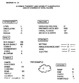
A
COMMON "FARMERS" LAND CAPABILITY CLASSIFICATION USED BY A
NUMBER OF RURAL VALUERS
RURAL
CAPABILITY SCHEME
LAND
SUITABLE FOR REGULAR CULTIVATION
CLASS
1
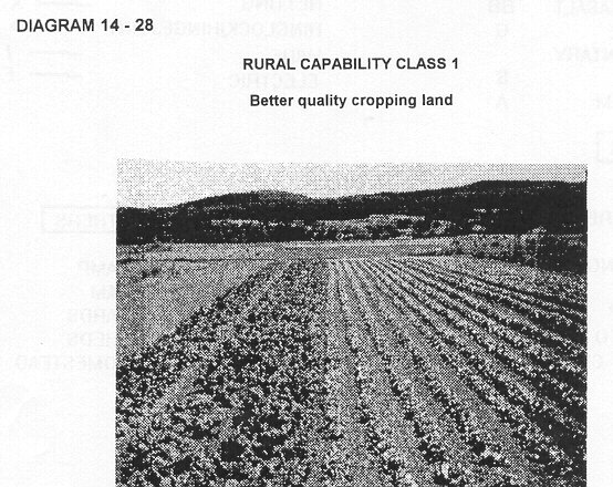
GENERAL
DESCRIPTION
Cropping
Land -- No erosion hazards: Capable of a wide range of agricultural
uses and regular cultivation for cropping (cereals, oilseeds, fodder
etc.) or intensive horticulture (vegetables, orchards). Includes
"agricultural lands" and many areas prepared for irrigation
schemes.
LAND
ATTRIBUTE GUIDELINES
CLIMATE:
Not exposed to recurrent extremes which reduce productivity.
SLOPE:
0-2%--flat
TERRAIN:
Commonly plains, except drainage plains.
DRAINAGE:
Good, though may be flood liable with low long term cost.
SALINITY:
No salting evident.
EROSION
HAZARD: Nil to low.
SOIL
CONSERVATION REQUIREMENTS: No special measures are needed.
RURAL
CAPABILITY CLASS 1
Better
quality cropping land
CLASS
2
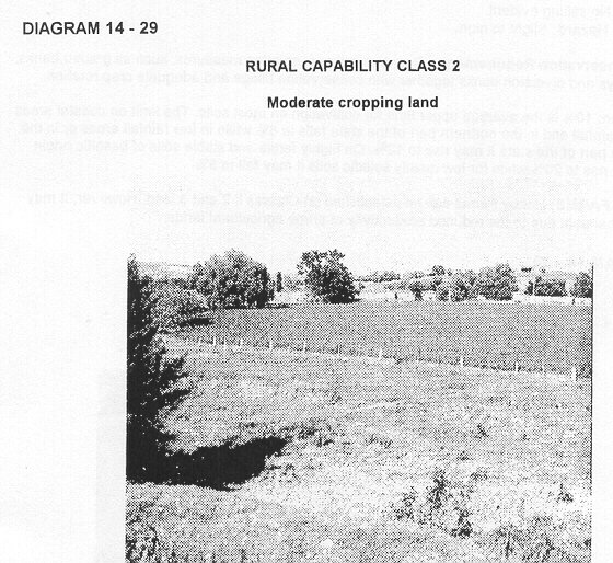
GENERAL
DESCRIPTION
Cropping
Land--Minor to moderate erosion hazards
Capable
of supporting a wide variety of agricultural uses similar to Class 1.
Can include "prime agricultural lands" and irrigated lands.
LAND
ATTRIBUTE GUIDELINES
CLIMATE:
Not exposed to recurrent extremes which significantly reduce
productivity.
SLOPE:
2-5%--plain.
TERRAIN:
Commonly plains, except drainage plains.
DRAINAGE:
Moderate to good, though may be flood liable with a low to moderate
long term cost.
SALINITY:
No salting evident.
EROSION:
Hazard Low.
SOIL
CONSERVATION REQUIREMENTS
Requires
simple soil conservation measures, such as strip cropping,
conservation tillage and adequate crop rotation.
RURAL
CAPABILITY CLASS 2
Moderate
cropping land
CLASS
3
GENERAL
DESCRIPTION
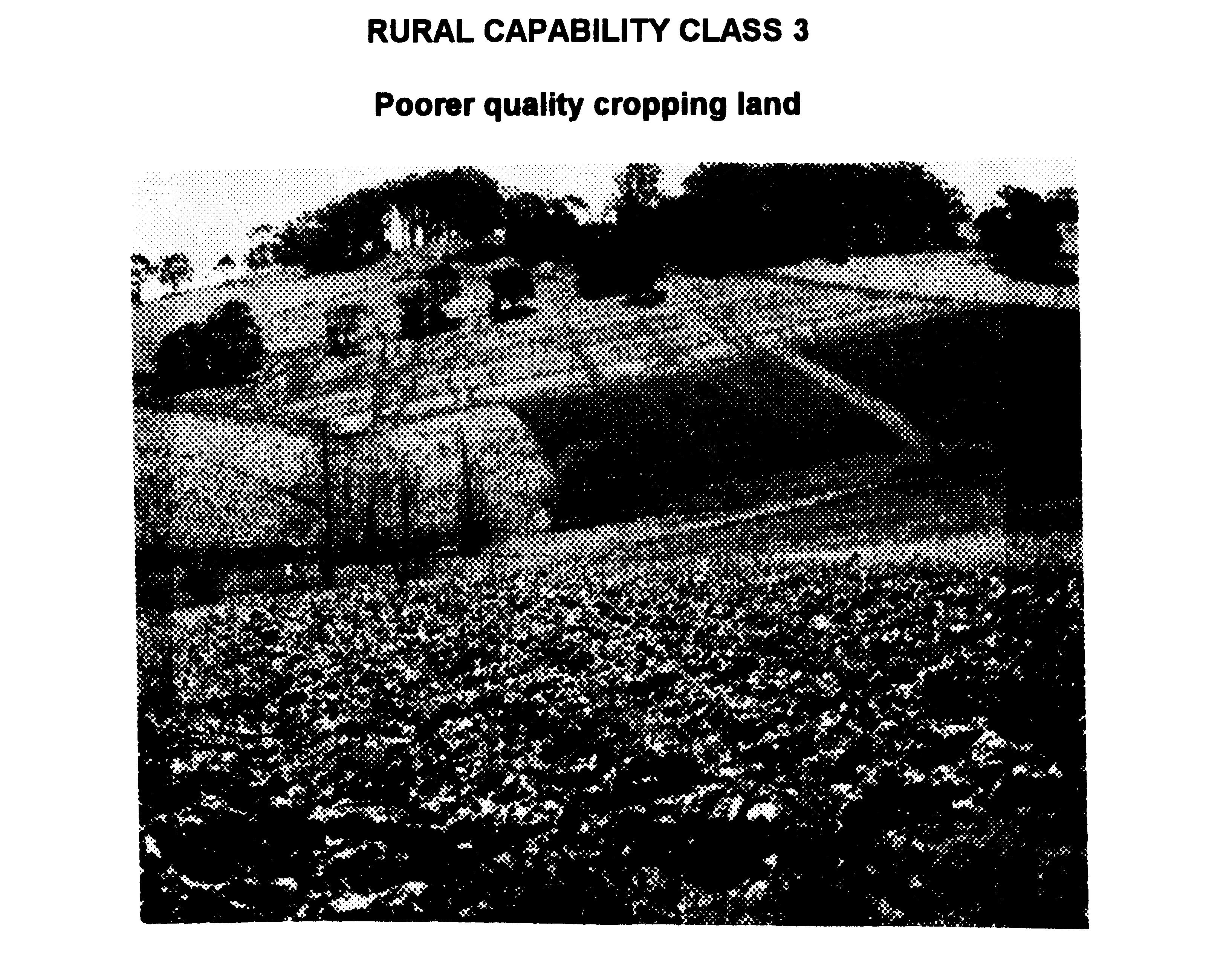
Cropping
Land--Moderate to severe erosion hazards Sloping land suitable for
cropping on a rotational basis. Generally used for the
production
of the same type of as listed for Class 1, although productivity will
vary depending upon soil fertility. Individual yields may be the same
as for Classes 1 and 2, but increasing restrictions due to the
erosion hazard will reduce the total yield over time.
Soil
erosion problems are often severe. Generally fair to good
agricultural land.
LAND
ATTRIBUTE GUIDELINES
CLIMATE:
Favourable for sensitive crops.
SLOPE:
<10% where soil erosion hazard vary from moderate to
high--undulating
TERRAIN:
Sideslopes and footslopes
DRAINAGE:
Well drained with good water holding capacity. Economic loss due to
flooding is low to moderate over the long term.
SALINITY:
No salting evident.
EROSION
HAZARD: Slight to high.
SOIL
CONSERVATION REQUIREMENTS: Requires soil conservation measures, such
as graded banks, waterways and diversion banks together with
conservation tillage and adequate crop rotation.
EXCEPTION:
10% is the average upper limit for cultivation on most soils. The
limit on coastal areas of high rainfall and in the northern part of
the state falls to 8% while in low rainfall areas or in the southern
part of the state it may rise to 12%. On highly fertile and stable
soils of basaltic origin this may rise to 20% while for low quality
solodic soils
it
may fall to 5%.
HOBBY
FARMS: Hobby Farms can be established on Classes l, 2 and 3 land.
However, it may not be desirable due to the reduced productivity of
prime agricultural lands.
RURAL
CAPABILITY CLASS 3 Poorer quality cropping land
SUITABLE
FOR GRAZING
CLASS
4
GENERAL
DESCRIPTION
Grazing
Land--Suitable for occasional cultivation with few to
no
erosion hazards. Lands capable of pasture improvement and occasional
cash or forage crops but not the range of agricultural uses listed
for Class 1 to 3. May accept hobby farms if adequate provisions are
made for water supply, effluent disposal and selection of safe
building sites and access Capability limited by slope, soil erosion,
shallowness or rockiness, climate or a combination of these factors.
LAND
ATTRIBUTE GUIDELINES:
SLOPE:
Up to 20%--rolling to hilly. (Includes soils that would otherwise be
in Classes I to 2 excepting slope ranges from 10% to 20%).
TERRAIN:
Sideslopes; plains where soils are poor
DRAINAGE:
Good to poorly drained.
SALINITY:
Nil
EROSION
HAZARD: Slight to moderate
SOIL
CONSERVATION REQUIREMENTS: Requires simple soil conservation
measures, such as pasture improvement, stock control, application of
fertilizer and minimal cultivation for permanent pastures.
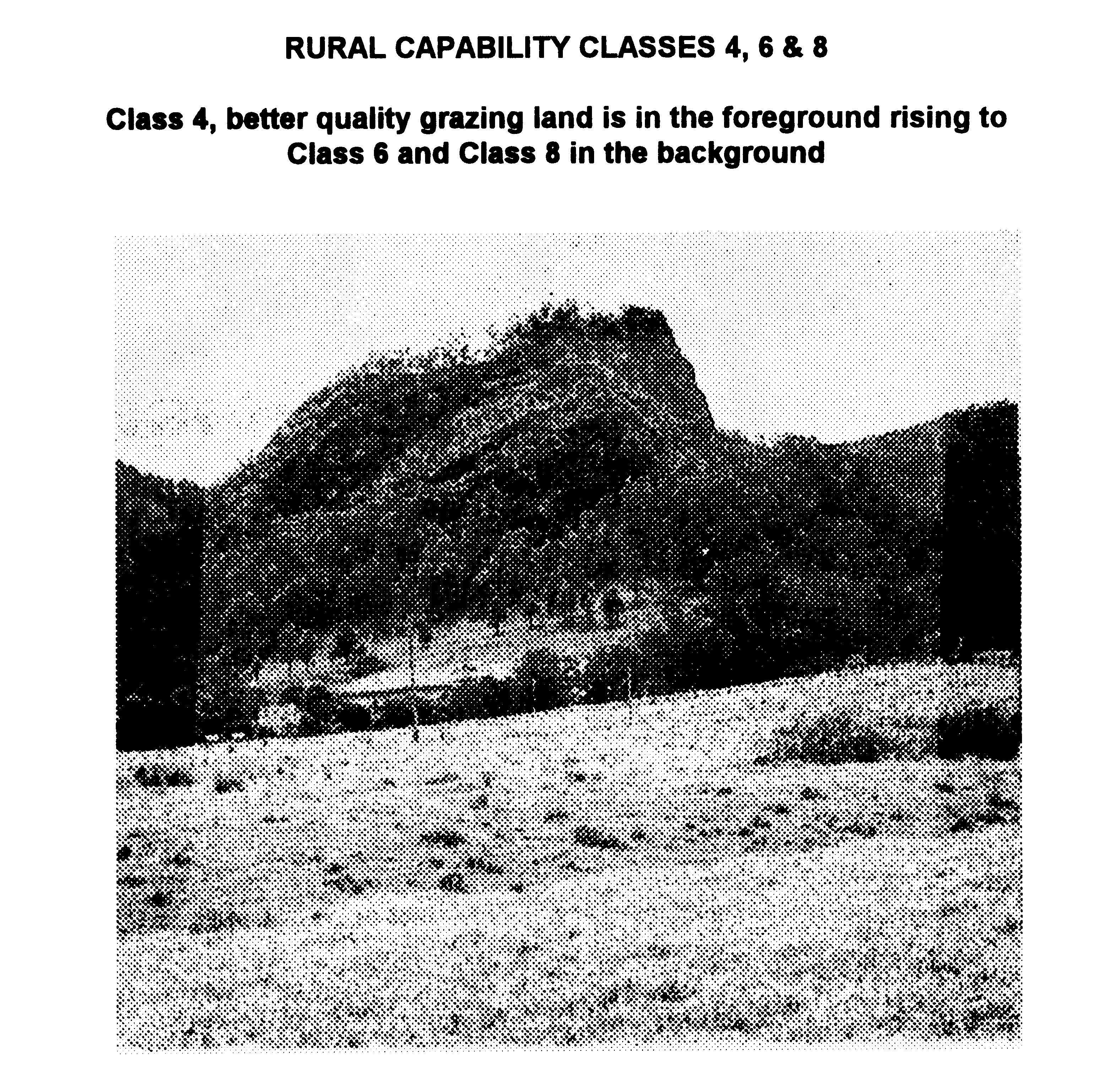
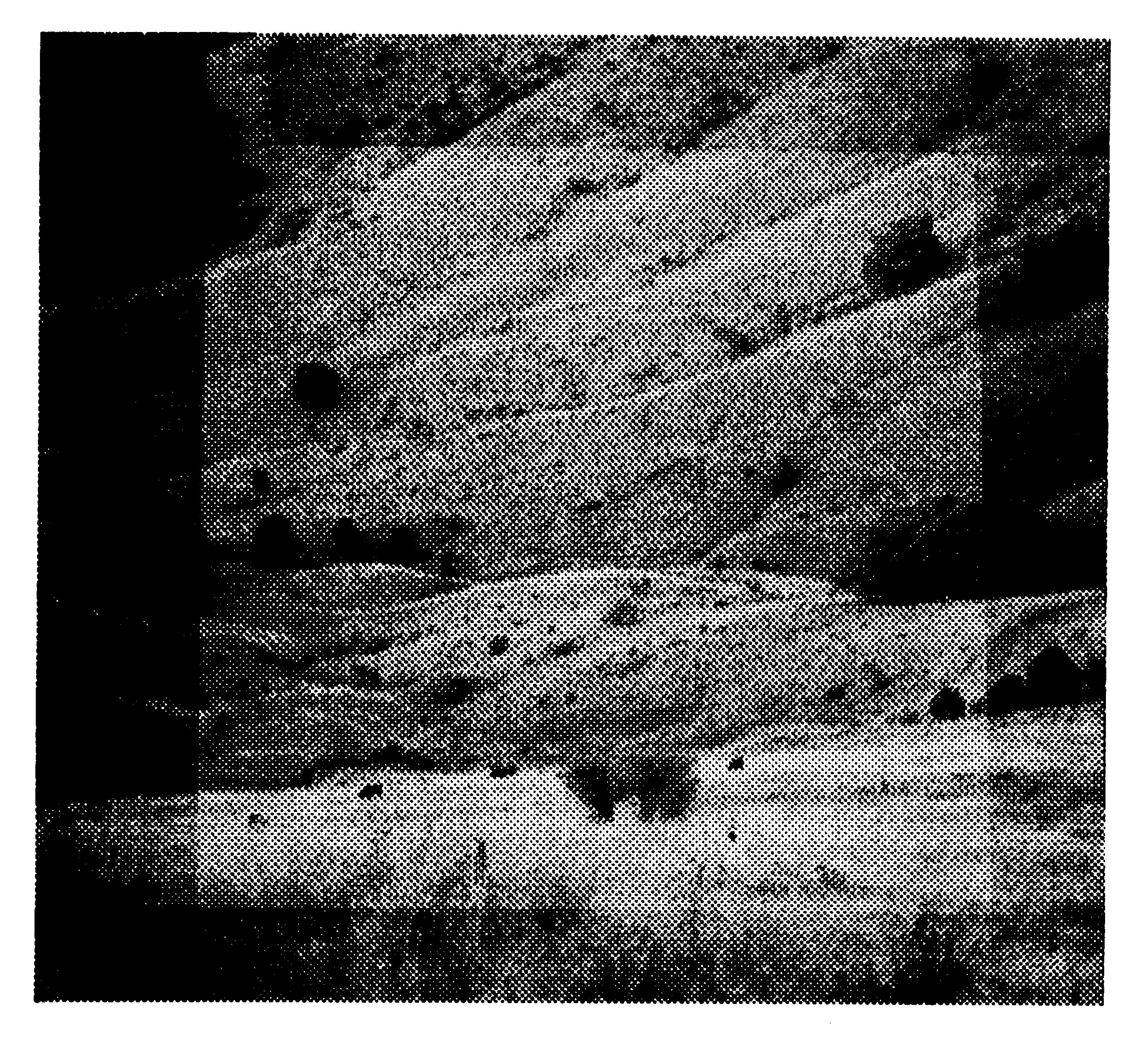
See
below example of classes 4,6,& 8:
CLASS4:
BETTER QUALITY GRAZING LAND IS AT THE FOREGROUND RISING TO CLASS 6
AND CLASS 8 IN THE BACKGROUND
CLASS
5
GENERAL
DESCRIPTION
Grazing
Land--Suitable for occasional cultivation with
moderate
to severe erosion hazards. Land capable of pasture improvement and
occasional cash or forage crops but productivity is generally lower
than for grazing lands in class 4. Soil erosion hazard requires more
intensive measures than class 4.
Capability
considerably limited by slope, soil erosion hazard, shallowness or
rockiness, climate, or a combination of these factors. If used for
hobby farms, adequate provision should be made for water supply,
effluent disposal and selection of safe building sites and access
roads.
LAND
ATTRIBUTE GUIDELINES
SLOPE:
10-20%--rolling to hilly (or lower sloping lands if soils are poor.)
TERRAIN:
Sideslopes
DRAINAGE:
Moderate to poorly drained
SALINITY:
May occur in low lying depressions, usually where drainage is impeded
by natural or man-made structures
EROSION
HAZARD: Moderate to very high
SOIL
CONSERVATION REQUIREMENTS: Requires intensive conservation measures
such as absorption banks, diversion banks and contour ripping,
together with management practices as in Class 4 land. (NB 20% is an
average practical limit for the use of mechanical equipment.)
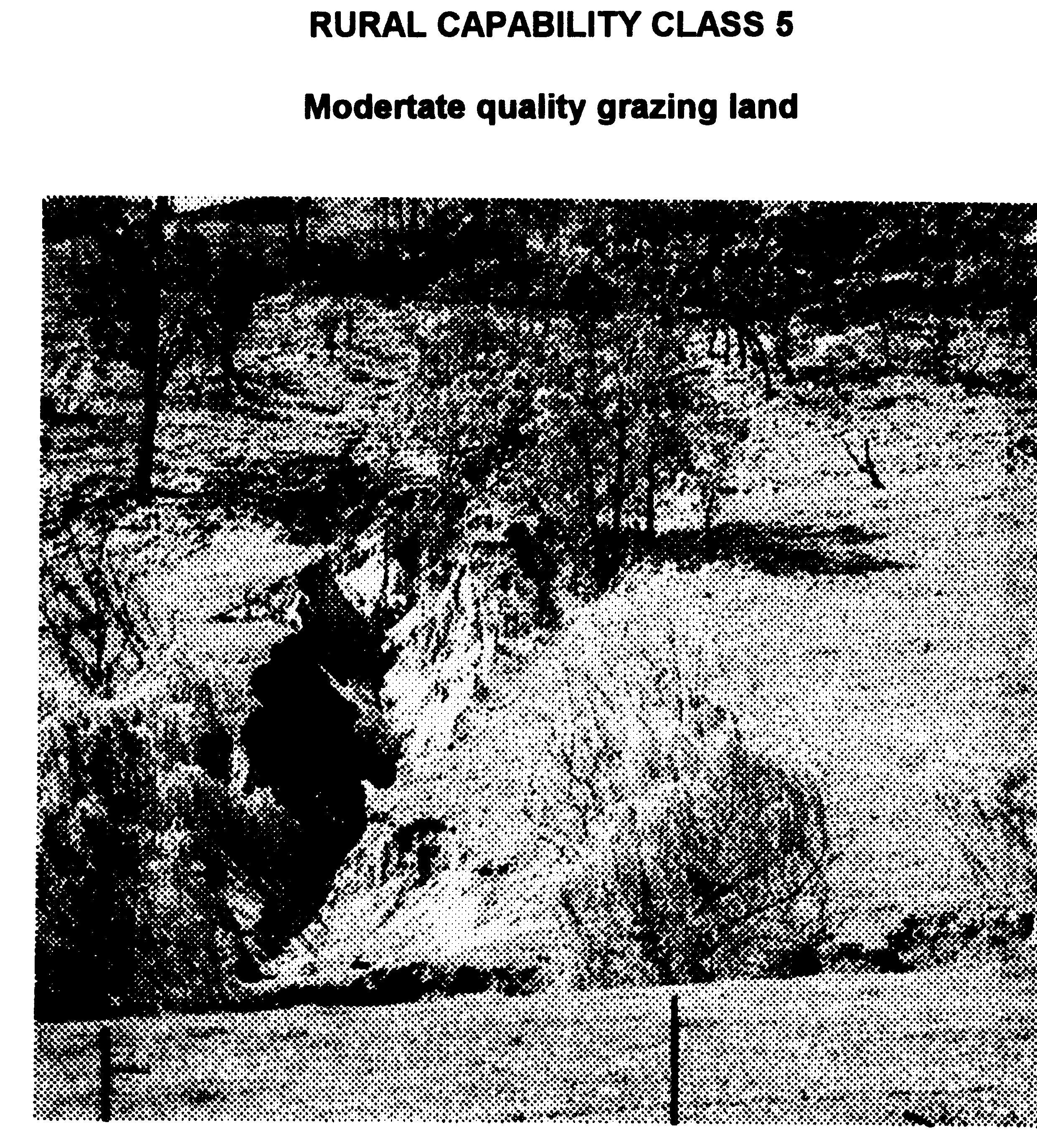
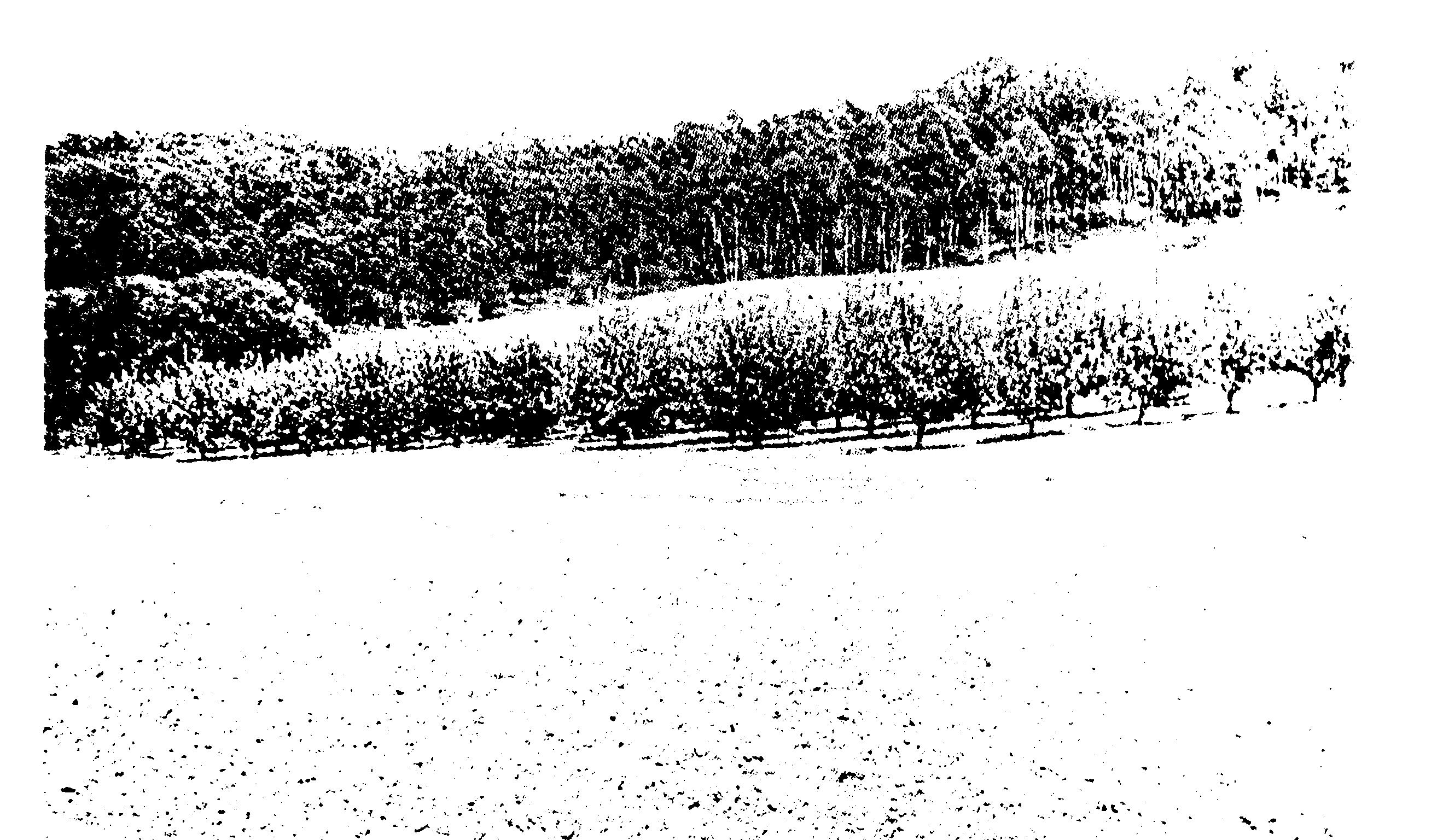
See
diagram below of Class 5 moderate quality grazing land:
CLASS
6
GENERAL
DESCRIPTION
Grazing
Land--Not Suitable for cultivation: Land capable of grazing but not
cultivation. Grazing based on native pastures or improved pastures,
relying
on minimum tillage techniques. If used for hobby farms, adequate
provision should be made for water supply, effluent disposal and
selection of safe building sites and access roads.
LAND
ATTRIBUTE GUIDELINES
SLOPE:
20-331/3,--steep to mountainous (or lower sloping lands if shallow or
very rocky.)
TERRAIN:
Sideslopes
DRAINAGE:
Land may be subject to periodic inundation and high watertable,
however, these are of short duration or can be economically solved.
eg draining.
SALINITY:
Salting can be evident
EROSION
HAZARD: Moderate to very high
NOTE:
The occurrence of feral and noxious animals and weeds may be high on
this land but does not impose a severe limitation to grazing.
SOIL
CONSERVATION REQUIREMENTS: Requires limitation of stock,
broadcasting
seed and fertilizer, prevention of fire and destruction of vermin,
possibly gully control structures, but intensive earthworks are
impractical.
NB.
Slopes over 331/3% or 18° in a notified catchment have timber
clearing or destruction restrictions under the Soil Conservation Act,
1938).
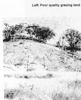
Class
6 poor quality grazing land:
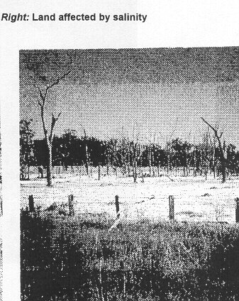
Class
6 land affected by salinity:
OTHER
LAND
CLASS
7
GENERAL
DESCRIPTION
Land
Best Suited to Timber: Land best suited to timber due to erosion
hazard, steepness, shallowness or infertility.
LAND
ATTRIBUTE GUIDELINES
SLOPE:
Generally 331/3-50%,--mountainous or deeply dissected. (However, may
occur on slopes < 33'/3% if soils are shallow, infertile or poorly
structured etc. eg. slopes < 10% on sandstone plateaux) AND has
one or more of the following:
DRAINAGE:
Frequently flooded or ponded drainage.
SOILS:
Shallow, evident to strongly saline, high to extreme erosion hazard.
FERAL
ANIMALS/ WEEDS: Uneconomic
SOIL
CONSERVATION REQUIREMENTS: Stock should be excluded and, when
cleared, land should be allowed to revert to timber.
SEE
EXAMPLE IN DIAGRAM 14-34 LAND BEST SUITED TO TIMBER AS IT IS AFFECTED
BY LANDSLIP AND REQUIRES VEGETATION
CLASS
8
GENERAL
DESCRIPTION
Land
Unusable for Agricultural or Pastoral Use
Land
unusable due to severe limitation of land attributes.
LAND
ATTRIBUTE GUIDELINES
SLOPE:
Generally > 50%--precipitous. However may occur on lesser slopes
where soils exhibit one or more of the following:
- Stoniness or Rockiness
- Erosion Hazard
- Soil Physical Handicap
- Salinity or Salt Hazard
- Permanent Freestanding Water eg Swamps
- Flooding/Tidal
- Toxicity
- Feral Animal and Weed Population
SOIL
CONSERVATION REQUIREMENTS
Land
best suited to nature conservation, scenic protection or
FURTHER
GUIDELINES - DEPARTMENT OF ENVIRONMENT AND PLANNING LAND EVALUATION
AND DEPARTMENT OF AGRICULTURE
Further
to the capability classification above the two departments have
issued the following guidelines to help the assessment of land
capability.
CLASS
1
Land
capable of regular cultivation (cereals, oilseeds, fodder) or
intensive horticulture (vegetables, orchards). It has a very good
capability for agriculture where there are only minor or no
constraints to sustain high levels of production. It includes
irrigated areas with high production. All, or nearly all, of the
following conditions are to be satisfied:
- Lands are either level or very gently sloping
- Soils are deep, well to imperfectly drained, and have good
water holding capacity.
- Soils can be maintained in good tilth and productivity
- Erosion damage is nil to slight and potential for future
damage is low.
- Productivity is high to moderately high for a wide range
of adapted field crops.
- The soils have a moderate to high capability to withstand
frequent cultivation and artificial irrigation without serious damage.
- Any adverse soil physical and chemical restraints are
capable of economic amelioration.
- Economic losses caused by floods are low in the long term.
- Lands are not likely to accumulate excessive salt or
develop high water tables following irrigation.
- Lands are not exposed to recurrent extremes of climate to
an extent that productivity is seriously affected.
- Intensive production has been facilitated by existing
local or regional infrastructure (such as drainage schemes, irrigation
networks or levee banks) except for those parts which have suffered
damage beyond economic amelioration.
CLASS
2
Land
suitable for cultivation or cropping, but not suited to continuous
cropping or intensive horticulture. It has good capability for
agriculture, except where constraints limit the cropping phase to a
rotation with improved pastures thus reducing the overall level of
production.
CLASS
2 LANDS CAN BE EITHER (A) OR (B):
(a)
where pockets of Class 1 land are too small for general agricultural
use and occupy between 25% and 75% inside a zone of a lower class,
then that whole zone should be placed in Class 2 provided that the
productivity of crops appropriate to that zone is very high;
otherwise the zone should be included in Class 3.
(b)
all or nearly all of the following conditions are to be satisfied:
- Land may be level to moderately steep
- Soils are deep to moderately deep, well drained and have
good available water capacity.
- Climatic and environmental conditions are particularly
favourable for sensitive crops whose cultivation would be seriously
impaired in adjacent areas with less favourable characteristics.
- Erosion damage or hazard is low to moderate: soil
conservation measures may be required.
- Soils have a moderate to high capacity to withstand
frequent cultivation and artificial irrigation without serious damage,
except for those on steeper lands which have a low capacity and require
conservation works.
- Soils can be maintained in good tilth and productivity
- For a wide range of field crops, adapted to the region,
their productivity is high to moderately high.
- Any adverse soil physical and chemical restraints are
capable of economic amelioration.
Economic
losses caused by floods are low in the long term.
- These are lands where existing local or regional
infrastructure (such as drainage schemes irrigation networks or levee
banks) has been provided for intensive production--except for those
parts which have suffered damage beyond economic amelioration.
- Lands are not likely to accumulate excessive salt or
develop prolonged high water tables following irrigation.
CLASS
3
Land
suitable for grazing and pasture improvement, and can be cultivated
for an occasional cash crop or forage crop in conjunction with
pasture management. The overall level of production is moderate as a
result of high environmental costs which limit the frequency of
ground disturbance. Has a moderate capability for agriculture.
Pasture
land capable of sustained high levels of production, although
conservation measures may be required. More than one condition is to
be satisfied:
- Lands have either many moderate or few severe limitations
of those listed under Class 5, restricting the extent of arable
agriculture.
- Sustained high to moderately high levels of productivity
of pastures adapted to the region are easily maintained.
- Lands may be very gently to steeply sloping
- Soils may be deep or shallow, well drained or poorly
drained.
- Erosion damage is nil to moderately severe but
conservation works are feasible.
- Under artificial irrigation, level lands are incapable of
sustained high levels of production because of unsuitable soil physical
properties incapable of economic amelioration.
CLASS
4
Land
suitable for grazing and not suitable for cultivation. Agriculture is
based on native pastures or improved pastures relying on minimum
tillage techniques. The overall level of production is low.
Environmental constraints make arable agriculture uneconomic.
All
or nearly all of the following conditions are to be satisfied:
- Lands are hilly or rolling with steep or moderately steep
slopes.
- The degree of stoniness or rockiness is slight to severe
but not extreme.
- Erosion damage or hazard is moderate to severe and control
works are necessary; severely eroded areas are only capable of economic
restoration by the establishment of permanent pasture.
- Soil physical handicaps are sufficiently severe to prevent
cultivation but will allow some pasture growth providing year- round
feed for a low stocking rate.
- While extremes of salinity, salt hazard, toxicity,
deficiency, acidity or alkalinity may be present, they are not severe
as to prevent plant growth but instead may combine to depress yields
seriously and place severe restrictions on the range of suitable
pasture species.
- Where land is subject to periodic inundation and high
watertables, these conditions are generally of short duration.
- Where permanent high watertables exist, the land can be
drained sufficiently to permit some pasture growth.
- The density of bush or scrub may be low to high, but not
extremely high.
- While the population of feral and noxious animals is high,
it does not impose a severe limitation to grazing.
- Where the density of weeds is high, successful eradication
is only possible by a continuing programme.
CLASS
5
Land
suited for only rough grazing or Land not suited to agriculture.
Agricultural production is very low or zero. Severe or absolute
constraints to production are imposed by environmental factors. The
lands have either a single or very severe limitation or a combination
of two or more severe limitations from the following list are
present:
- Extremes of- slope; stoniness or rockiness; erosion hazard
or damage by wind or water;
- Soil physical handicaps
- Salinity or salt hazard
- Surface water of flooding
- Toxicity of deficiency
- Acidity or alkalinity
- High watertables incapable of economic drainage; or bush
or scrub uneconomic to clear.
- Large populations of feral animals inhabit the area.
- High densities of weeds and timber regrowth which are
uneconomical to eradicate
- These are timbered or previously . timbered upland areas
where clearing has led or may lead to excessive movement of salt into
the groundwater.
(The
extra guidelines end at Class5)
FARM
PLANS
A
farm plan details and maps the resources of the land (land classes,
soil types, waterways) and provides a guide for long term planning of
paddock design, crop types, rotations and soil conservation
strategies which are appropriate for sustainable production on the
land units identified in the plan.
The
diagram below shows a number of alternative land uses, classes of
land that have different land use capabilities and management
requirements. Scrub is retained on rocky hilltops, pasture on steep
slopes, perennial horticulture is on the middle slopes and
cultivation
of vegetables is on the lower slopes. Land used and managed within
its capability has a low risk of degradation by water erosion.
LAND
CAPABILITY MAP
23