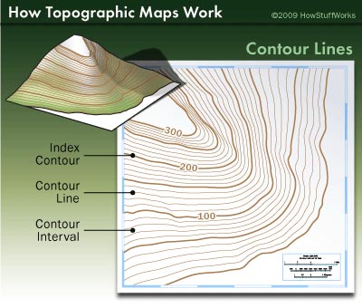
A line on a map or plan that indicates points of the same elevation above or below the adopted datum (eg sea level). A contour line is drawn on a map or plan to indicate where the surface of the ground is of equal height above the datum. Contour lines above sea level are shown on topographic maps.